Tuesday
March 28 – Lexington Ky to Land between the Lakes KY
We
were in no hurry to leave as the trip to Land Between the Lakes is
248 miles, about 4 hours of driving time. And will will gain on hour
when we cross back into central time. The road we took is I-69 which
is also referred to as the Bluegrass Parkway. What a wonderful road!
It is a divided limited access highway and this day there was very
little traffic. I also noticed the lack of billboards which was
really nice. The Redbuds were in bloom and where showing there stuff
the entire route. Our destination was Hillman Ferry Campground in the
Land Between the Lakes National Recreation Area (LBL) and we arrived
there mid afternoon which gave us plenty of time to find our site and
settle in before dark.
Where
we are parked: Hillman Ferry Campground in the Land Between the
Lakes National Recreation Area KY, Area C, Site 19, $22/night ($28
minus $6 with the Geezer card), water and 50 amp electric, no sewer
but they have a dump station. All the sites are gravel however there
is a lot of elevation changes through out the park with many pads
perched on the side of hills. We were able to get a first come first
served site on the water. However the lake was drawn down so the
water level was low.
Wednesday
March 29-Land Between the Lakes - temps: High 70º, Low 54º
Today
we went into Calvert City to get some parts for the camper. We have
been having problems with the hydraulic system for the slides and
level up system. The pump has been shutting down while operating the
slides and landing gear. Dennis reached out to the RV Facebook groups
and they suggested some things to check and a possible fix. We headed
into town to get some hydraulic fluid since it was low and a electric
breaker. Also stopped to pick a few groceries. We went a different
way back to the camper which took us past the LBL visitor center. We
stopped there and spent some tome going through the museum on the
history of the area.
The
Land Between the Lakes National Recreation Area is a natural paradise
bounded on the west by Kentucky Lake which was created by damming the
Tennessee River and on the east by Lake Barkley which was created by
damming the Cumberland River. It is 170,000 acres of forest and open
lands with camping, hunting, fishing, off-highway vehicle riding,
horseback riding in addition to miles of trails for hiking and
biking. There is approximately 300 miles of shoreline within the park
boundaries. The park has dedicated itself to restoring some of the
natural flora and fauna of the area including reintroducing bison and
elk to the area.
We
left the visitor center and traveled a short distance down the road
to the Elk and Bison Prairie. It cost $5 to enter. A paved road takes
you through the prairie. There was a small herd of bison right next
to the road and eagle eye Dennis spotted some elk way off in the
distance through the trees. We returned to the camper via the
Woodland Trace road which runs the entire length of the park from
north to south.
 |
| Bison |
 |
| Redbud Flowers |
Thursday
March 30- LBL - temps: High 76º, Low 49º
Today
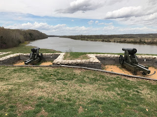
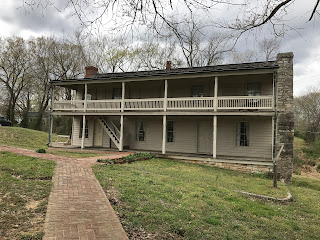
we planned to visit another Civil War battlefield located at the
southern end of LBL. I made a pot of soup in the pressure cooker then
we headed out. Our destination was the Fort Donalson Battlefield
located near Dover TN. This was another pivot-able battle in the war.
Fort Donalson along with Fort Henry were constructed by the
Confederacy to guard the Tennessee and Cumberland Rivers from Union
invasion. Fort Donaldson was especially strategic as it guarded the
Cumberland River and access to Nashville which was a major supply hub
for the southern armies.


